
India Roadkill Monitoring Portal
Crowdsourced wildlife conservation and road ecology intelligence across India.
Client / PartnerWildlife Researchers & Conservation Coalition of India
Production PhaseLive / Deployed
Primary Toolchain
LaravelVue.jsPostgreSQL
The Challenge
Linear infrastructure (highways, expressways, rail corridors) cuts through critical wildlife habitats, leading to unrecorded animal mortality and lack of actionable spatial data for highway planners.
Architecture & Solution
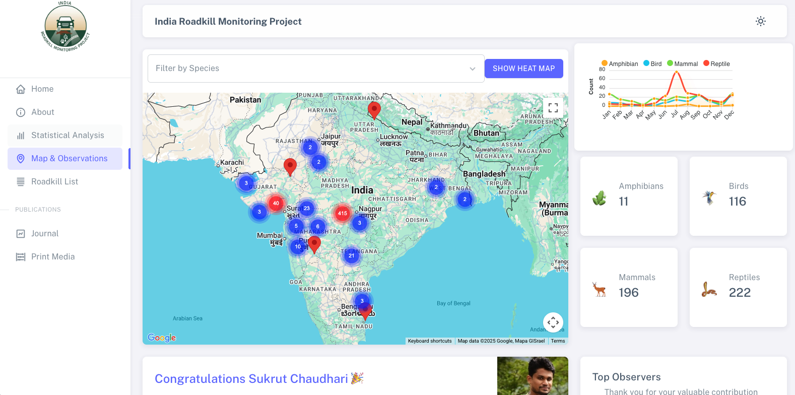
Created a geospatial reporting and scientific data platform with citizen science mobile submissions, automated species identification validation, and GIS density heatmaps to identify mortality hotspots.
Key Features & Deliverables
Geotagged photographic reporting of roadkill incidents with GPS coordinates
Expert biological taxonomy validation workflow for rare and endangered species
Interactive spatial heatmaps highlighting dangerous highway stretches
Exportable analytical reports for National Highway Authority and Ministry submissions
Technology Stack
Backend: Laravel API server with spatial extensions
Frontend: Vue.js dynamic SPA with interactive Mapbox/Leaflet GIS layers
Database: PostgreSQL with PostGIS extension for spatial queries and polygon intersections
Results & Project Metrics
120+ Corridors
Hotspots Identified
15,000+
Reports Catalogued
18+ Papers
Research Citations
Need a similar solution engineered?
Consult with our engineering team to design, build, and deploy your custom system.